Easter Island in the South Pacific
In a recent discussion with a friend about isolated islands, I was reminded of a documentary I saw several years ago about Easter Island. It focused on the giant statues and the history of the island, but also had a little about the current population. Looking on a map and seeing how far from anywhere Easter Island is, I had to wonder how anyone ever got there and, once they did, why they stayed. I don't have all the answers, but I have found some links to share with you about the island's history and current status. I have to say, though, that I would be afraid to live out in the middle of the ocean on a tiny piece of land. The ocean is so vast and deep and spawns tsunamis and typhoons. Still, Easter Island is interesting and, from what I've read and seen on the web, it has a certain charm.
I'm going to share four links with a variety of information and photos. You can, of course, do a search on Easter Island and get all sorts of material, from travel information to ecological information and everything in between. I had hoped to find more on the people who live there now and what they do, but had to settle for bits and pieces gleaned from articles about the history and the statues. If you know of a good link about modern day Easter Island, feel free to put the url in a comment.
The links:
Easter Island in Words and Pictures
Rapanui (Easter Island) by Dr. Grant McCall (book excerpt)
Easter Island History
Easter Island at Wikipedia (You know the drill--confirm wikipedia info with another source.) (Actually, that applies to anything!)
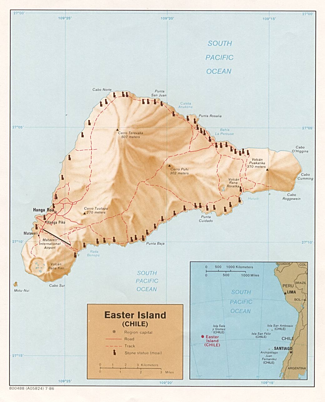
Also, there is a map of Easter Island here.
There are some minor discrepancies in details between the above sources, such as how far from other places Easter Island is, but you can get a nice overview of the island from these sources and the links they provide.
Easter Island is about 63 or 64 square miles in size and roughly triangular in shape. From the Easter Island History link above, we learn that:
Easter Island (or Rapa Nui) is one of the world’s great archaeological sites, and also one of the most remote. The nearest inhabited island is tiny Pitcairn, over 1,200 miles [1,931 kilometers] to the west. Rapa Nui is almost 2,500 miles [4,023 kilometers] from the coast of South America and, in the other direction, it is 2,000 miles [3,219 kilometers] to Tahiti. Its isolation is one of the key factors affecting the culture that evolved here.Can you imagine living so far from other inhabited lands?!
The general story goes that the island got its name this way: "Easter Island's long isolation was ended on Easter Sunday in 1722 when a Dutch explorer, Jacob Roggeveen, found the island. He named it for the holy day." (Again, from the Easter Island History link above.)
The native name was Rapa Nui and that name is still used somewhat today. It is generally believed that Polynesian people settled on the island about 300-400 A.D., but some think the settlement was much later (800-1200 A.D). Some also believe there is South American influence, too, and not just Polynesian.
Wikipedia says, "Population at the 2002 census was 3,791 inhabitants, up from 1,936 inhabitants in 1982." There are people--a number of people--living there today. Tourism is a major income producer for the island, which has been annexed by Chile (and has a Spanish name of Isla de Pascua), although it has a local governor now. Dr. McCall's link above provides a factual summary of information about the island and, if you scroll down to the "History" section, you can read a detailed account of the island's dealings with Chile.
The Easter Island in Words and Pictures link will take you to a site with fantastic photos and a brief write-up of the basic information about the island.
I just think it is so fascinating that people found and settled such an isolated island. They settled in to stay and developed a civilization. They even had developed the only written language in Oceania (a name given the group of many islands in the Pacific), called rongorongo, which no one has been able to decipher. Thor Heyerdahl arrived in 1955 with the Norwegian Archaeological Expedition and they were the first to do excavations and attempt to come up with dates for the various findings.
This is just a brief summary of some of the information you can read about in the above links. The material is fairly short and the Easter Island in Words and Pictures page has a Resources page with a number of links.
Enjoy the geography lesson!
posted by Mary @ 5:37 PM
0 comments
![]()
![]()

0 Comments:
Post a Comment
<< Home